🎯 For Developers, Builders & Property Owners
If you own, manage, or are planning work on a property and need accurate visual documentation — not just pretty footage — this case study shows exactly how drone mapping fits into real-world projects.
I currently offer:
- Drone mapping & site documentation
- Orthomosaics & property overviews
- Construction progress flights
- Real estate aerial media
Watch this week’s video 👇:
📩 Request pricing or book a project:
Context: What This Case Study Was
This project was a hands-on drone mapping test performed on a real residential property in the Chicago area.
The goal was not marketing.
The goal was to:
- Practice a real mapping workflow
- Capture structured aerial data
- Produce deliverables that mirror what developers, contractors, and inspectors actually need
- Validate timing, effort, and pricing for future paid work
This was designed as Case Study #1 — the foundation for a series of mapping and construction documentation projects.
The Objective
Instead of cinematic shots, this mission focused on:
- Accuracy over aesthetics
- Repeatability over creativity
- Data capture over storytelling
The primary deliverable was a clean orthomosaic map that clearly shows:
- Property boundaries
- Roof geometry
- Lot layout
- Surrounding context
This is the type of output that supports:
- Pre-construction planning
- Site measurements
- Documentation before renovations
- Long-term progress tracking
The Process: How the Mapping Mission Worked
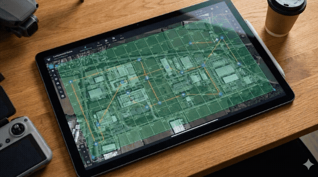
1. Mission Planning
Before flying, I created a structured flight plan designed for mapping, not video.
Key parameters included:
- Grid-based flight pattern
- Consistent altitude
- High overlap for accurate stitching
- Slow, controlled speed
I also checked:
- Airspace clearance
- Wind conditions
- Lighting consistency
- Battery requirements
Planning time: ~15 minutes.
This step is critical — mapping quality is decided before the drone ever leaves the ground.
2. Gear & Software Setup
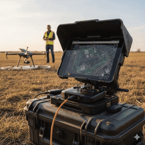
For this mission, I used:
- DJI drone capable of mapping workflows
- Automated flight software
- Standard camera settings optimized for consistency
- iPhone/Insta360 for behind-the-scenes capture
No specialized surveying hardware.
No enterprise-only gear.
This is important because it proves that entry-level mapping is accessible, while still delivering real value.
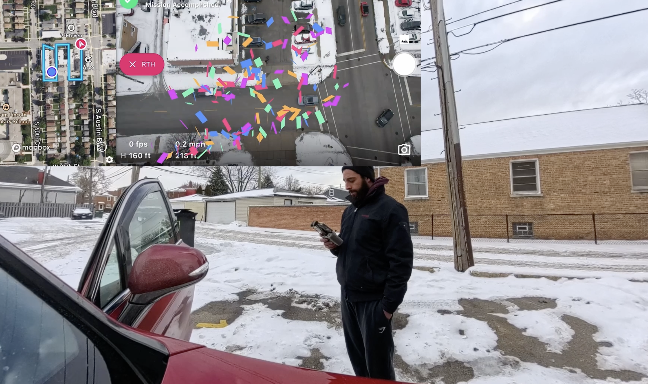
3. Flying the Mission
Once launched, the flight was fully structured and predictable.
- Automated grid execution
- Consistent altitude across the site
- Overlapping passes for clean stitching
- No manual cinematic moves
Total flight time: ~12–15 minutes
Batteries used: 1
The key difference from real estate video work is discipline — letting the mission run without creative interference.
4. Processing & Output
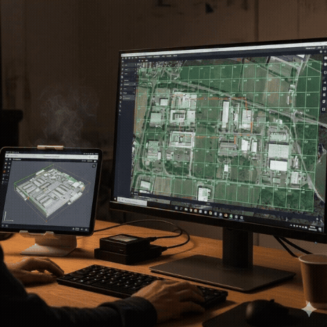
After capture, the images were processed to generate:
- A stitched orthomosaic map
- High-resolution overhead imagery
- A clean visual reference of the entire property
Processing time varies depending on dataset size, but this project required minimal post-production compared to video editing.
The Deliverable: What This Project Produced
Final Outputs:
- High-resolution orthomosaic map
- Property-wide overhead view
- Export-ready imagery for reports or planning
- Archivable documentation for future comparison
Estimated Market Value: $249–$350
(depending on site size and usage)
Why This Case Study Matters
This project validates something important:
Drone mapping is not complicated — it’s systematic.
Compared to real estate video:
- Less creative decision-making
- Fewer revisions
- Clear scope
- Higher perceived value
This single mapping flight:
- Took under 45 minutes total
- Required no advanced equipment
- Produced a deliverable that can support $250+ pricing
- Scales easily with larger sites
How This Connects to Construction & Development
This is the entry point.
The same workflow used here scales directly into:
- Construction progress documentation
- Pre-construction site capture
- Renovation before/after records
- Developer reporting
- Asset management
Instead of one-off videos, mapping enables:
- Monthly retainers
- Long-term projects
- Repeat clients
- Higher-ticket contracts
Services I Currently Offer
If you’re a property owner, builder, or developer, I currently offer:
- Drone mapping & site documentation
- Construction progress flights
- Real estate aerial media
- Property overviews & inspections
📩 View packages or book a project:
Building This in Public
This is Case Study #1 of an ongoing series.
Every project I publish is real. Every workflow is documented. Every number is transparent.
Upcoming case studies include:
- A larger-scale mapping mission
- Construction progress tracking
- Paid client mapping work
- Packaging & pricing breakdowns
Location: Chicago Area
Project Type: Drone Mapping / Site Documentation
Category: Case Study