At Overwatch, we focus on helping buyers and sellers understand not just what a home looks like — but the environment it’s growing into.
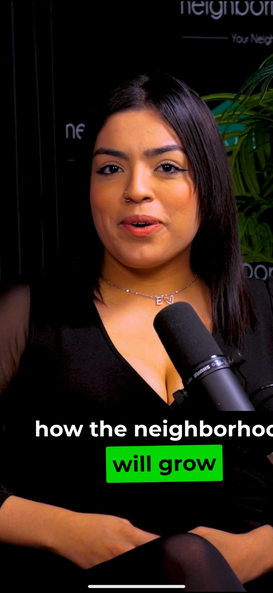
As part of our ongoing collaboration with Dream House Real Estate, we’ve released a new educational short highlighting a common blind spot in home buying: buyers evaluate homes as they exist today, not as they’re about to change.
When you purchase a home, you’re not just buying square footage and finishes.
You’re buying future roads, nearby development, traffic patterns, and commercial expansion — whether you realize it or not.
Aerial perspective makes that future visible.
Buying the Snapshot, Not the Trajectory
During a showing, neighborhoods often feel settled.
- Roads seem quiet
- Open land feels permanent
- Empty corners feel neutral
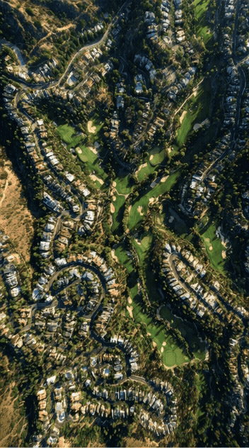
But from above, it becomes clear that many neighborhoods are mid-transition, not finished.
Grading, road stubs, lot outlines, and early construction activity often signal what’s coming next — long before signage or buildings appear.
Most buyers aren’t careless.
They’re simply evaluating a snapshot, not the trajectory.
What Aerial Context Reveals Immediately
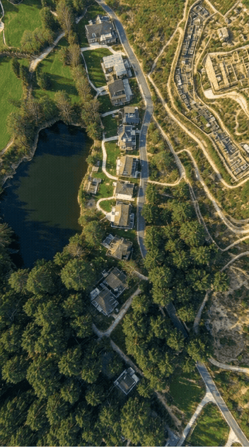
From an aerial vantage point, patterns emerge that are impossible to see from the street.
Drone footage can reveal:
- Planned road extensions
- Future housing phases
- Active and staged construction zones
- Commercial pads before development begins
This isn’t prediction.
It’s context that already exists, just not at eye level.
Seeing a neighborhood from above turns isolated observations into a connected system.
Growth Changes Value — and Daily Experience
Understanding what’s coming helps buyers think beyond first impressions.
Aerial context can clarify:
- Where traffic pressure will increase
- Which areas are likely to densify
- How commercial development affects convenience and noise
- Why appreciation differs between nearby homes
Value isn’t shaped by the home alone.
It’s shaped by what surrounds it — and how that changes over time.

This kind of analysis replaces assumptions with information.
Why Ground-Level Photos Miss This Entirely
Traditional listings are designed to present homes at their best.
They show:
- Clean exteriors
- Well-lit interiors
- Ideal angles and conditions
What they don’t show is:
- Where new roads will run
- How traffic patterns will shift
- Which open parcels are already planned
- How development pressure builds outward
Growth is gradual.
Static photos can’t tell that story.
A Visual Exploration of Neighborhood Growth (Short Film)
We’re currently producing a short film that explores this idea visually — using aerial perspective to show how neighborhoods evolve over time.
This project is intentionally experimental.
The goal isn’t polish — it’s perspective.
Watch the short film here 👇:

The Overwatch Perspective
At Overwatch, we use aerial data to analyze neighborhoods as systems, not snapshots.
That means:
- Observing patterns over time
- Identifying signals before they’re obvious
- Sharing the process openly as it develops
This isn’t about selling certainty.
It’s about doing the research before assumptions take hold.
Why This Matters for Buyers, Agents, and Sellers
For buyers, understanding future context helps avoid surprises after move-in.
For agents, it adds depth and credibility to property conversations.
For sellers, it helps frame expectations and attract informed buyers.
Drone perspective doesn’t replace inspections — it strengthens decision-making earlier in the process.
Closing Thought
Buying well means understanding more than what’s listed.
Aerial perspective doesn’t predict the future —
it reveals the signals already pointing toward it.
More breakdowns coming.
Overwatch — seeing the whole picture.